
INTERACTIVE LINE 3 MAP
The map above shows the new HDD River crossings that was approved by MPCA and Army Corps. in 2020.
DOWNLOAD the Line 3 Replacement Project Waterbody Crossing table
Enbridge will begin their roadway destruction crossings June 1, 2021. Here is a simple map indicating HDD River Crossings Destruction Dates.

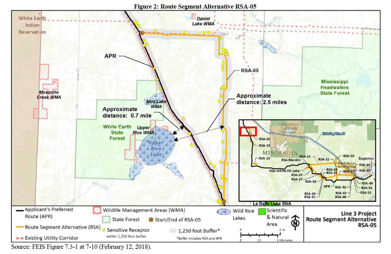
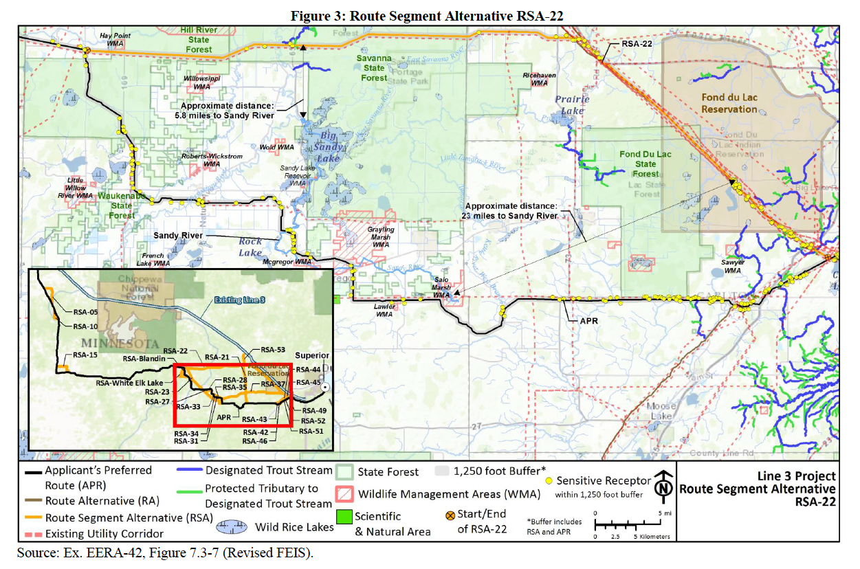
NOTE: This interactive map was updated in November 2018, to display the final route approved by the MN PUC, which is different from the route originally proposed by Enbridge and used in the Environmental Impact Statement. There were 2 major changes: 1) the new route makes a small jog east around Mud Lake and Upper Rice Lake in order to avoid the watersheds of the White Earth Reservation, and 2) it rejoins the existing Line 3 corridor (the Enbridge Mainline) near Floodwood and follows it across the Fond du Lac Reservation instead of turning south in Aitkin County to avoid the reservation, as originally proposed (the Fond du Lac Band agreed to this change on August 31, 2018). Here are the “Route Segment Alternative” maps showing these changes:
Mapping the Black Snake
This map was created in collaboration with the Twin Cities Branch of Science for the People.
DETAILED MAPS OF NEW ROUTE
These are the official maps (satellite imagery and topographic) of the final route approved by the State of Minnesota for Enbridge's new Line 3 corridor, and included in the Routing Permit for the project. In June 2018, the MN Public Utilities Commission voted to approve a new Line 3. On October 26, 2018, the PUC issued a Routing Permit. The final route includes 2 major changes to the route originally proposed by Enbridge, as explained above.

